T R A N S F O R M A B LE K N O W L E D G E

- ANOTHER CONSTRUCTED MYTH -
By Year 02106, the main radioisotope Cesium-137 will have finished it’s 4th half-life. By this time we can assume no human who experienced the catastrophe will still be alive. The catastrophe is now only understood through evidence and mediated information.
Since 1986, humans and future generations have become enslaved into a continuous battle to control and contain radiation; monitoring and maintenance became embedded overnight into the zones new culture. The knowledge of Toxic Urbanism becomes part of the labours of the site, such as the rigorous weedings of the lawn on the Soviets radioactive tombs to prevent the roots of stray tree saplings from cracking the clay.
Due to the nature of radiation and its half-life, the Exclusion Zone is one of the rare spaces on Earth where long-term perspectives are forcibly taken...Toxic Urbanism has investigated designing for extreme longevity through materiality, altering topography, engineering principles and retaining human disturbance. Future generations will be able to ‘map’ the landscape of Toxic Urbanism as system of related constructions.


Case Studies

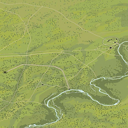
Satellite images reveal what can't be seen from the ground
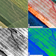
Technology aiding what the human eye struggles to see
Archaeology
Stonehenge Interconnected Landscape
Stonehenge Interconnected Landscape
Interconnected Landscapes
Control

The Long Now Foundation
Long-Term Perspectives/Thinking
Stonehenge

Future Learning for the Toxic Urbanism

Atelier Peter Zumthor & Partner AG
Shelter Roman Archaeological Site
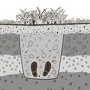
Forensic Archaeology
Future Imagery...

Urban spread along the boarder
Large mounds indicate human activity
Large area of hard surface
Remains of boundary wall coincide with the end of the grid pattern
- FORENSIC ARCHAEOLOGY -
0km
10km
Scale Bar
Illustrative future 'infra-red' image revealing the landscapes past,
In the future nature can be used as a foresenic tool to identify and interpreting changes in vegetation or soils that may be linked to human activity. The grid used to control wildfires, may become 'invisible' to the human eye in the future, but using tools such as infrared cameras and identify changes in vegetation will reveal the grid.

0km
10km
Scale Bar
Parts of the original wall can be depicted from where urban areas meet the grid
The topography has been significantly influenced by humans activities in the past where a number of mounds and depression have been created
- HUMAN ACTIVITY IDENTIFICATION DRAWING -
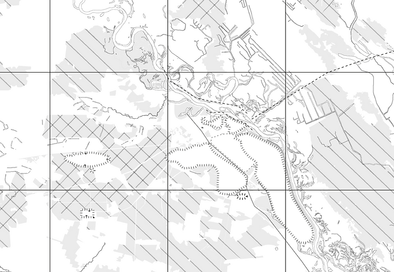
The map identifies areas of human activity and shows how the interventions relate to each other; together future generations will begin to build up a 'picture' of what the landscaped was used for and understand that it became a landscape of control and containment, through the layers of 'control lines and barriers.'
'Mound'
'Mound'
'Mound'
Hard Surface Remains
'Mound'
Depression
Depression
Earth Banks
Dikes
Hard Surface Remains
Identified changes in vegetation or soils, linked to human activity
- TOPOGRAPHICAL ANALYSIS -
Topographical mapping the central area of the landscape reveals significant impact by humans activities in the past where a number of mounds and depression have been created.
0km
10km
Scale Bar
The Future for the Site
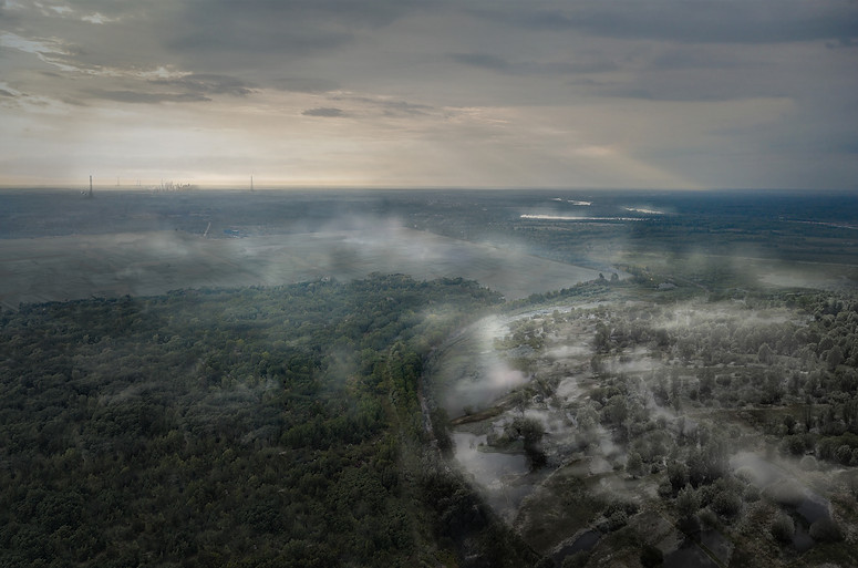
This image speculates the far future of the landscape, showing a hard landscaping which now covers the area where the Nuclear Power Station once stood. The cooling pond's footprint can be read through the change in vegetation, from deep forest to a wetland. A microclimate has adapted to the specific environmental conditions of the past cooling pond (The image is post the use of the cooling ponds as a floating solar farm, assuming a more production form of energy productions has been developed by this time.)