0 2
T H E G R I D

Case Studies

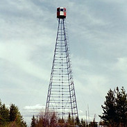
The Water Tower Typology


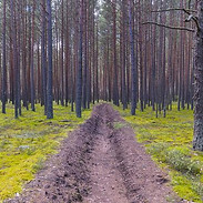
Control Lines
Wildfire defence preparations
Wildfire Watch Tower
Monitoring and defence Infrastructure

Satellite Detection Monitoring

Belerus
Ukraine
Radiation Levels between 0 - 5 Microsieverts per hours
Nuclear Power Station
Key - Site Location (Highlighted White Area)
TIMESPAN - 30 - X Years (A Scientist would need to be consulted as different areas's of the site require different treatments)
SITE'S RADIATION LEVEL - 0-5 Microsieverts per hours
SCALAR EFFECT - INTERNATIONAL
WILDFIRES
Wildfires pose a great threat, as winds spread radiation concentrated in the smoke and ash, far beyond the boarders of the Enclosure; such as the Wildfire this April where the smoke reached as far as Kiev,100 kilometers aways. [1] Radiation at the epicentre of the fire exceed the norm and are also extremely dangerous to combat.
CONTROL
Wildfires need three main element; a source of heat, fuel and oxygen. Eliminating one of these will stop the burning. [2]
The control strategy utilises the materiality of the void to prevent mass spreading of the fire. The demolition of trees creates control lines which reduces the fires 'fuel' to effectively none.
The control lines have been drawn out continuously in the perpendicular direction to the prevailing South-Westerly winds. And in the more heavily radiated areas, additional control lines in the South-Westerly direction create a smaller enclosed space to further protect from mass spreading.
The Grid's design has taken into consideration existing 'natural and man-made' control lines, for examples rivers, lakes, wetlands and roads.
MONITORING
To ensure the combat of wildfire's occurs as quickly as possibly to reduce the amount of radiation released; 24/7 monitoring must exist. Integrating with existing observation infrastructures such as satellites in the geostationary obit, can provide this service to continuously monitor the area and alert when a wildfire is detected.
(Satellites in the geostationary orbit means they continuously stay above the same area on earth and are usually used to 'observe weather and other phenomena that vary on short timescales' [3])
LONG TERM ADVANTAGES - CONTAINMENT
The system is designed to protect the health of local environments and urbanisms from radiation escaping the zone.
[3] - https://earthobservatory.nasa.gov/features/OrbitsCatalog/page2.php
Key Words - Monitor, Control
Issue - Wildfire's Spread Radiation

Mapping 'The Grid'
Photographic evidence that the control line's aid the mass spread of wildfires

Image - Extract from the New York Times (April 11, 2020 by Maria Varenikova)
The control lines have been drawn out perpendicular to the prevailing South-Westerly winds. In the heavily radiated areas, additional control lines create smaller enclosed grids to provide further protection against heavily radiated wildfires.
The layout has considered existing 'natural and man-made' control lines, for example rivers and roads.
Stills from Presentation Animation
The concept of the animation was to start by showing a close up of two control lines cross, the camera slowly zooms out revealing the massive extent of the entire site.

Still 1
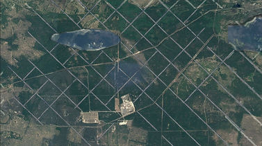
Still 3

Still 2
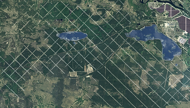
Still 4...(Video continues to zoom out until the entire site can be viewed.)
Detailed Drawings

Map depicting control line strategy
(including natural and man-made boundaries to 'mass wildfire fuel')

Satellite Imagery from a wildfire in April 2020 show the winds blowing the smoke in a South-Westerly direction.

Detailed Section Illustrates the deforestation of trees to create voids/'control lines'
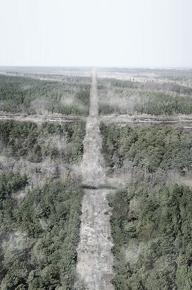
Perspective view of 'Typical Control Line'